Scope of Application
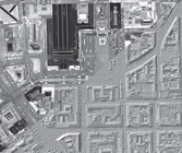
The results obtained by laser mapping flights offer a multitude of options. As varied as the scope of activity of our customers (e.g. land survey or coastal protection agencies, forestry, geosciences, water and navigation authorities) are the possible ways to use the altitude data.
Digital models of terrain surfaces and object surfaces (e.g. city models, vegetation models) can be provided in different grid sizes for a large variety of applications. There is also a wide range of output formats for the gathered information (files with ground or vegetation points, elevation profiles, contour maps or slope maps).