Building Mapping
Building mapping and/or the resulting urban models are increasingly used in areas like historical preservation, noise protection, urban marketing, urban planning, telecommunication and insurance.
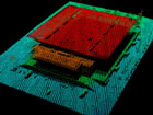
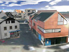
The level of detail (LOD) varies depending on the application in hand – from a point cloud to a simple surface model to a complex building model that includes the texture.
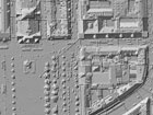
Building geometries can be developed on the basis of laser mapping data. On the other hand, image data are indispensable where complex models with a high level of detail and texture information are required.