Mapping Systems
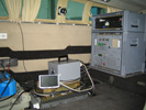
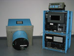
TopScan owns different ALTM (Airborne Laser Terrain Mapper) made by Optech which can be installed both in aeroplanes and in helicopters. The ALTM Gemini and the ALTM 3100 were currently in use.
Technical Data
| ALTM 3100 | ALTM Gemini | |
|---|---|---|
| Model year | 2005 | 2008 |
| Sampling mode | 100.000 Hz | 167.000 Hz |
| Scanning mode | 4 Pulse | 4 Pulse |
| Scan angle | 0° - + 25 ° | 0° - + 25 ° |
| Range | 80 – 3.500 m (265 - 11.500 ft) |
150 – 4.000 m (500 - 13.200 ft) |
| Beam divergence | 0.3 mrad | 0.25 mrad |
| Swath width | 0 – 0.93 x altitude above ground | 0 – 0.93 x altitude above ground |
| Intensity | yes | yes |
| Video | yes | yes |
| Digitale camera | Rollei AIC-modular-LS, DMC | Rollei AIC-modular-LS, DMC |
| GPS | Trimble 10 Hz | Trimble 10 Hz |
| IMU/INS | POS AV 510 | POS AV 510 |
| Waveform | yes | yes |
| Scan frequency | Depends on scan angle | Depends on scan angle |
The oldest Measuring System from TopScan is the ALTM 1020. It is the first commercial laser scanner wherewith more than 53.000 km² area would be collected and evaluated in the years from 1993 till 2001. Because of the increase requirements the system can unfortunately not be used economical any more.