Solar Potential Analysis
Laser scanner data for location analysis of photovoltaic plants

A new, computer-assisted process has been developed in the context of a research project of the University of Applied Sciences Osnabrück (SUN-AREA) to carry out fully automatic location analyses for photovoltaic and thermal solar power plants. This is a subject that is receiving more and more attention in environmental discussions about renewable energies.

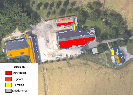
The optimum locations for generation of solar power are determined on the basis of laser and base map data, and taking into account local factors such as exposition, inclination, shadowing and global insolation.
The calculation results can be visualized both in tabular and graphical form, and integrated into existing geographic information systems.
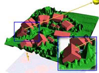
Schematic representation
| inclination | 41 |
|---|---|
| Building class | Residential building |
| Building type | Agricultural residential building |
| Roof surface | 307,36795 |
| Power yield | 38482,883 |
| Global current generation | 1112,9009 |
| Global current - percent | 95,675797 |
| CO2 infeed | 19780202 |
| Orientation | 213 |
| Suitability | Excellent suitability |
| Size factor | 250 |
Roof surface with various degrees of suitability
Source of pictures: SUN-AREA