Airborne Stock
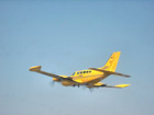
The measurement systems of TopScan GmbH can be installed both in aircraft and in helicopters.
Laser mapping flights by airplane are performed in cooperation with our partner of many years, Hansa Luftbild Sensorik und Photogrammetrie GmbH.
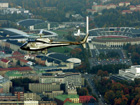
TopScan also offers helicopter-borne laser mapping in cooperation with KMN Koopmann helicopter GmbH. The lower flight speed and flight altitude of helicopters provides an economical way to achieve higher spot densities and higher image resolutions.
Technical Data Aircrafts
| Cessna 404 | Cessna 402 | Cessna 210 | Pilatus Porter | |
|---|---|---|---|---|
| Range | approx. 2.200 km | approx. 1.300 km | approx. 1.200 km | approx. 900 km |
| Power | 750 hp | 600 hp | 275 hp | 550 hp |
| Speed range | 200 – 340 km/h 110 – 185 kn |
180 - 300 km/h 100 - 160 kn |
165 - 275 km/h 90 - 150 kn |
130 - 215 km/h 70 - 116 kn |
| Max. flight time | approx. 8 hours | approx. 5 hours | approx. 5 hours | approx. 4,5 hours |
Technical Data Helicopters
| AS 350 BA | AS 350 B3 | |
|---|---|---|
| Range | approx. 700 km | approx. 640 km |
| Power | 640 hp | 840 hp |
| Speed range | 55 - 230 km/h 30 - 125 kn |
55 - 250 km/h 30 - 135 kn |
| Max. flight time | approx. 3 hours | approx. 3 hours |